

Local News
NASA Released a Zika Virus Prediction Map of the US, and It Doesn’t Look Good for Texas
Zika, a virus transmitted through a particular female mosquito, could wreak havoc in the United States, and NASA is predicting where it will hit the hardest.
NASA has been enlisted to help officials determine the spread of the Zika virus before it becomes a national epidemic. The factors that most contribute to the spread of the virus, as stated by NASA, are “temperature, rainfall, and socioeconomic factors.” These were taken into account and mapped with the help of the National Center for Atmospheric Research in Boulder, Colorado.
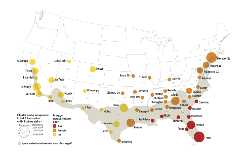
The map above shows the potential risk for the United States based on cities in certain regions. Red dots are the highest risks for the money of July, with orange meaning a moderate risk, and yellow being a low risk. We could see higher numbers of the female Aedes aegypti mosquito across the eastern and southern parts of the nation as summer will bring humid conditions to this regions.
Additionally, it also shows that the mosquitoes can survive in myriad different weather situations if they arrive in a place at the right time. While the mid-Atlantic region of the U.S. would traditionally be too cold for the insects to thrive, if they come in the late spring, as researches assume they might, the virus could spread more easily throughout the summer.
