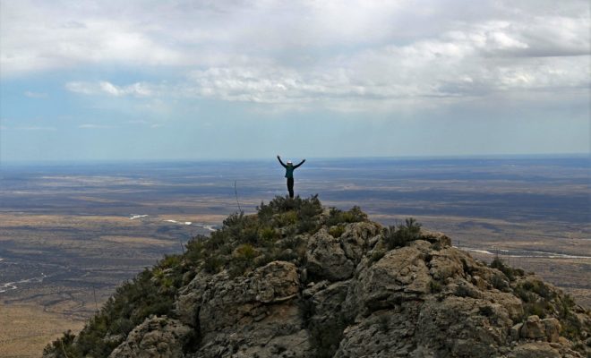
In 2018, Guadalupe Ridge was named as a national recreation trail by the U.S. Department of the Interior. Out of 19 such appointments that year, this hiking trail is the longest at 100 miles. It’s also the only one that allows hikers to cross state lines. In a remote part of West Texas, traversing through to a similarly remote part of New Mexico, it’s an amazing way to see nature in its wildest form.
This 100-mile hiking trail connects two national parks. The Guadalupe Ridge Trail is recognized as an “extreme hiking trek” by the National Recreation Trail database. It begins in Texas at Guadalupe Mountains National Park and ends in New Mexico at Carlsbad Caverns National Park. Those entertaining a trip on this unique and historic pathway can do so in segments if they wish. The opportunity to have one foot in Texas and one in New Mexico on a beautiful hiking trail is something a rare group of people has done.
Photo: Facebook/Guadalupe Ridge Trail
Mountains, vast canyons and valleys, creeks and chasms are all par for the course on the Guadalupe Ridge Trail. A landscape that appears so familiar and yet foreign to human contact opens up to hikers with each step into its wilderness. Nature has no boundaries, and so, despite the fact that trailblazers recognize their ability to traverse two states, a mountain range, and the Lincoln National Forest on this trail, the flora and fauna will change in its own time, with its own agenda, over the course of the hike.
Photo: Pexels
Fresh drinking water is the integral component for hikers wishing to complete the full 100-mile Guadalupe Ridge Trail. The backcountry of the national parks yields nothing in the way of fresh water. To complete the hike without dehydration becoming an issue, one would need to hike with seven gallons over the course of the trail (at one gallon per day). This is why many opt to see the entire trek in sections, as noted above. Since the terrain in question is infamous for sharp swings in temperature and precipitation changes (remember, you’re traveling through mountains, forests, and parts of the Chihuahuan desert), it’s prudent of anyone planning this trip to do their homework in advance for packing and preparation. Is it worth it to complete the full trip? To those looking to set their own goals and smash them, absolutely! It’s an amazing opportunity to witness pristine parts of both states with access at various segments of the trail. This is the hiking opportunity of a lifetime, and it’s right here in our own backyard.