
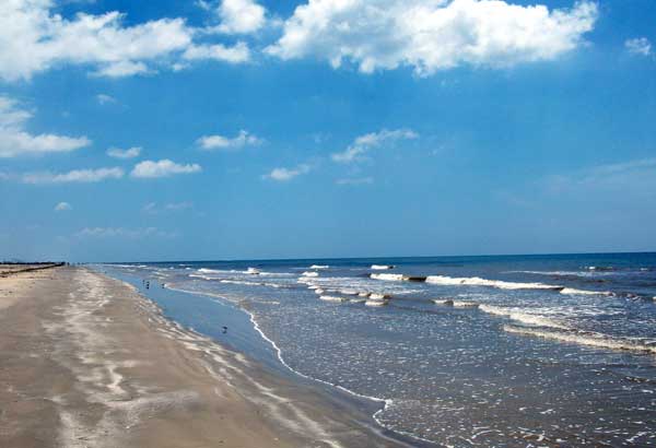
According to the National Oceanic and Atmospheric Administration (NOAA), Texas has 3,359 miles of shoreline miles. The coastline itself is 367 miles. Millions of people flock to the Texas coastline every year. If there are concerns about bacteria levels in any of the beaches there is a customized tool to check bacteria levels. The Coast Guard Investigative Service website for health risks associated with swimming in waters through the interactive Texas Beach Watch website gives detailed information for each beach.

Quizzes
Texas Beaches [QUIZ]
By |
1. Captain Robert Mercer brought his family to this eighteen-mile-long barrier island in 1853. This island is located in far eastern Nueces County. A state park was established in 1972 which includes more than five miles of beach. Dunes on this beach can be as tall as 35 feet high.
 Texas Beaches Quiz
Correct!
Wrong!
2. A barrier island and home of the famous Fort Velasco. The conflict that occurred here marked the beginning of the Texas Revolution. Texan forces were stopped by Mexican troops as they attempted to move cannon up the Brazos River to reinforce fellow colonists in Anahuac.
 Texas Beaches Quiz
Correct!
Wrong!
3. 23 miles east of Brownsville, this location is known as, the “Survivalist Beach”. There is no camping and no facilities, you will have to bring your own food and beverages. This secluded beach may soon become more populated as SpaceX held a launch site groundbreaking ceremony in September 2014. A first launch from there is expected in 2018.
 Texas Beaches Quiz
Correct!
Wrong!
4. This popular spring break destination’s beach runs from the south end of Closed Beach to the Mansfield Channel. All camping in this area is primitive and open to RV and tent camping.
 Texas Beaches Quiz
Correct!
Wrong!
5. A small unincorporated community located in the eastern corner of Matagorda County. The town and its beach are named after a man from England that became a major landowner by 1838. This man and his daughter-in-law succumbed to a hurricane in 1875. The site was awarded a Historical Marker by the Texas State Historical Commission in 1986.
 Texas Beaches Quiz
Correct!
Wrong!
6. This beach is on Mustang Island. Experts have said that the islands along the Texas coast began life as submerged sand bars about 4,500 years ago. The first known human occupants of the island were the Karankawa Indians.
 Texas Beaches Quiz
Correct!
Wrong!
7. A salt dome about 38 feet high on the Bolivar Peninsula at the eastern end of Galveston County. Once inhabited by pirate Jean Laffite, it said to contain a treasure that has not been found.
 Texas Beaches Quiz
Correct!
Wrong!
8. A 52-acre beachfront park located in Brazoria County with amenities and overnight facilities. The park includes the site of Fort Bates (1862), the remains of the Freeport Harbor Defense (1942), and two historically significant houses.
 Texas Beaches Quiz
Correct!
Wrong!
9. Two miles outside Port O'Connor on the northern end of Matagorda Island, this beach is open to visitors but only accessible by boat from either the Gulf or Pass Cavallo. The refurbished Matagorda Lighthouse, which dates from 1852 is closest to this beach. Matagorda Island offers no services, amenities or water.
 Texas Beaches Quiz
Correct!
Wrong!
10. A barrier island adjacent to Matagorda Island west of Aransas Bay. On July 26, 1845, Lt. Chandler of the USS Alabama waded ashore and planted the first American flag to fly over Texas territory.
 Texas Beaches Quiz
Correct!
Wrong!

Texas Beaches
I got %%score%% of %%total%% right
