
 Jason Weingart
Texas Hill Country News
Strong Storms Possible This Afternoon and Evening Across the Hill Country
All forecast images credit: Pivotal Weather
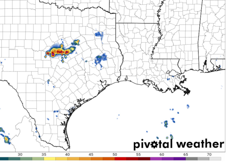
Forecast models are showing a line of strong storms traversing the Texas Hill Country this afternoon and evening. The worst weather should be along and west of I-35 late this afternoon into the early evening. The main threat with these storms will be severe winds, frequent lightning, and heavy rains. Large hail and tornadoes are not anticipated.
The main threat with these storms will be severe winds, frequent lightning, and heavy rain. Large hail and tornadoes are not anticipated. This is reflected in the Storm Prediction Center’s Day 1 Outlook, which has placed the area in a ‘marginal’ risk for severe weather.
A mesoscale convective system over Northern Texas will show renewed thunderstorm development over the next few hours. This will occur generally west of Waco.

The storms are forecast to quickly grow upscale into a line of storms then push south.
The Northern Hill Country will be effected early this evening.

They may maintain strength as they pass over areas from Austin and to the west before weakening later tonight.

Of course, this is weather. Timing and storm strength are subject to change. Stay tuned to your local National Weather Service office and media outlets for the latest.
