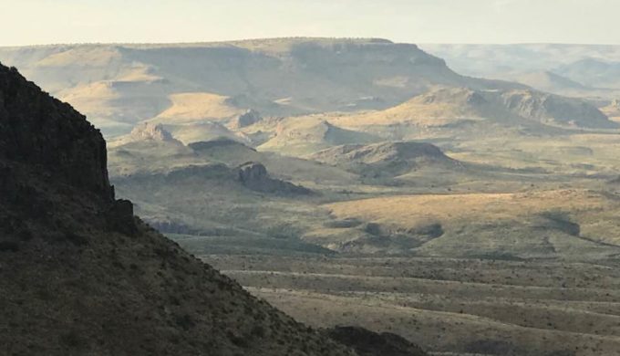
Located south of Pinto Canyon Road and immediately west of the high peaks of the range is the massive beauty of the over 38,000-acre Chinati Mountains State Natural Area. According to the Texas Parks and Wildlife Department (TPWD), the beauty of the mountains has a storied and violent past, especially regarding how the mountains came into existence.
Sitting among the Chihuahuan Desert ecoregion, “which stretches from the trans-Pecos area of Texas into northern Mexico,” states the TPWD, the Chinati Mountains are a result of “the largest volcanic eruption in the Trans Pecos region of Texas” which took place there eons ago.
Although, not accessible as a public park just yet, plans are already in place to begin the design, contracting, and construction of the area. “TPWD is working on acquiring land for public access to the park from FM 170.” No opening date is set, according to the TPWD website, but plans for the public use should be complete sometime in 2018.
Over the course of time, the steep canyons and rugged peaks have eroded, telling the storied past of that violet eruption that created the beauty of the Chinati Mountains. “Native Americans left their marks in the form of pictographs (rock paintings) and petroglyphs (rock carvings).” Throughout the years, mining activities took place in the area yielding silver, copper, and fluorspar. In the 1830s, ranching had also taken over the area.
Photo: Facebook/Wyman Meinzer
Plant life in the region includes mixed grasslands and mixed desert scrub along with Sotol, bear grass, yucca, and skeleton-leaf goldeneye. In terms of wildlife, you will find 10 species of bats as well as white-tailed and mule deer, bobcats, and mountain lions, just to name a few.
“Stretching from low desert to the highest peak, Sierra Pardo,” the park will be a gorgeous sight to gaze upon once it is open to the public. It will welcome guests with its impressive display of nature’s most beautiful assets, the towering mountains ready to unfold their history along the rugged paths.


